Detecting Washouts, Encroachments, and Erosion with Commercial Drones
Pipeline corridors and utility rights-of-way extend for miles across changing terrain. Maintaining visibility along these corridors is essential for safety, compliance, and asset protection—but ground inspections alone are slow, inconsistent, and often reactive.
Commercial drones provide a non-intrusive, high-level observation layer that helps operators identify developing issues early, prioritize ground response, and document conditions with clarity and consistency.
Washout Detection
Identifying failures before they become emergencies
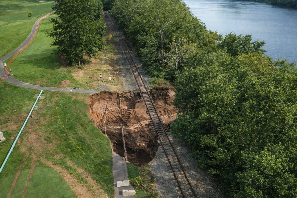
Washouts occur when water undermines soil supporting a pipeline or right-of-way, often after heavy rain, flooding, or drainage changes. These failures may not be visible from the ground until damage is already significant.
Drone observation helps detect:
- Undermined soil along slopes and crossings
- Exposed pipeline segments or supporting structures
- Drainage failures redirecting water toward the corridor
- Early surface changes that signal subsurface instability
Operational value:
- Early identification reduces repair scope and cost
- Faster post-storm assessments across long corridors
- Clear visual records to support maintenance planning
Encroachment Monitoring
Protecting corridor integrity and access
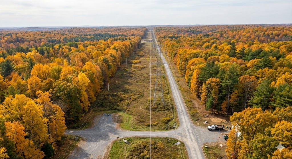
Encroachments—whether accidental or intentional—pose serious risks to pipeline safety and maintenance access. These can include structures, grading, vegetation growth, or equipment operating too close to the corridor.
Drone observation supports identification of:
- New construction or grading within right-of-way limits
- Unauthorized vehicle paths or access roads
- Vegetation regrowth impacting visibility or access
- Obstructions that complicate inspection or emergency response
Operational value:
- Earlier awareness before violations escalate
- Improved coordination with landowners or contractors
- Clear documentation for compliance and corrective action
Erosion Assessment
Seeing how water is reshaping the corridor
Erosion is gradual—but relentless. Left unaddressed, it can compromise slope stability, expose infrastructure, and accelerate washout risk.
Drones help evaluate:
- Soil movement along slopes and drainage channels
- Gully formation and runoff concentration
- Vegetation loss contributing to instability
- Areas requiring reinforcement or drainage improvement
Operational value:
- Proactive maintenance instead of emergency repair
- Smarter allocation of stabilization resources
- Reduced environmental and compliance risk
Why Drones Are Effective for Right-of-Way Observation
Pipeline and corridor management demands consistency, coverage, and documentation—three areas where drones excel.
Commercial drone operations provide:
- Rapid coverage of long, linear assets
- Repeatable observation flights for trend comparison
- Safer inspections without exposing crews to unstable ground
- Visual records that support internal review and regulatory reporting
Drones do not replace ground inspections. They guide them, ensuring personnel are sent to the right locations with the right information.
A Smarter Way to Maintain Corridor Integrity
Washouts, encroachments, and erosion rarely happen overnight—but they often go unnoticed until costs rise sharply. Drone-based observation gives operators earlier insight, better prioritization, and stronger operational control.
In pipeline and right-of-way management, seeing change early is the key to preventing failure later.