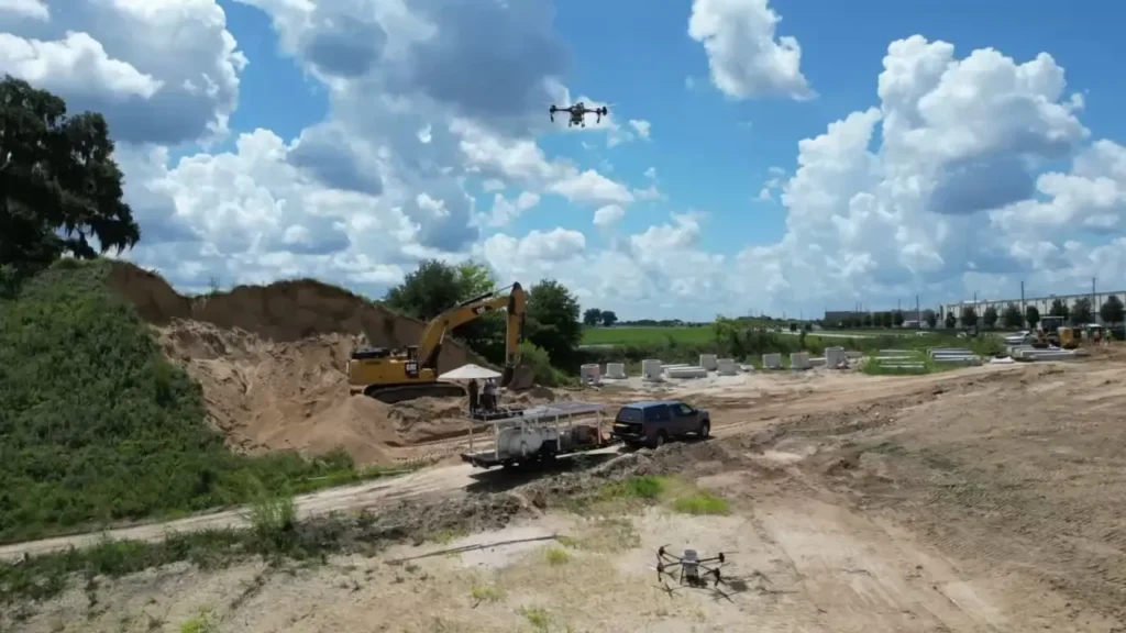
Drone aerial imaging has become an essential tool for the construction industry, giving project managers, engineers, and clients a clear view of their sites from above. With state-of-the-art drone technology, high-resolution images and videos can be captured quickly and accurately, making it easier to monitor progress, plan logistics, and identify issues before they become costly problems.
One of the greatest advantages of aerial imaging is the ability to track project development over time. Regular drone flights provide consistent, real-time updates that can be compared to blueprints and schedules. This helps ensure that work is staying on track and allows teams to make data-driven decisions with confidence. The precision of modern drone sensors also means that measurements and maps are highly accurate, often replacing or supplementing traditional surveying methods.
In addition to progress tracking, drones are transforming safety and efficiency on construction sites. Aerial views reduce the need for workers to physically access dangerous or hard-to-reach areas. Teams can assess roofs, tall structures, or excavation sites without putting anyone at risk. This not only improves safety but also saves time and resources. Clients benefit as well, since drone imaging provides a transparent record of how their investment is being managed at each stage.
By integrating our drone aerial imaging into construction workflows, companies gain a powerful tool for planning, communication, and quality control. As technology continues to improve, it’s clear that drones are no longer a luxury for construction firms – they are becoming a standard part of doing business.
You can also inquire about aerial imaging for your construction projects by calling us at (813) 624-3484.