Replanting Assessment and Access Road Planning
Forestry and timberland management is a long-term discipline. Decisions made today—where to replant, how to access a stand, and how to move equipment—can affect productivity, safety, and costs for decades. Commercial drones provide a practical, aerial perspective that helps landowners and managers make better-informed decisions before committing crews, machinery, or capital.
Two of the highest-value use cases are replanting assessment and access road planning.
Replanting Assessment
Seeing regeneration clearly, early, and at scale
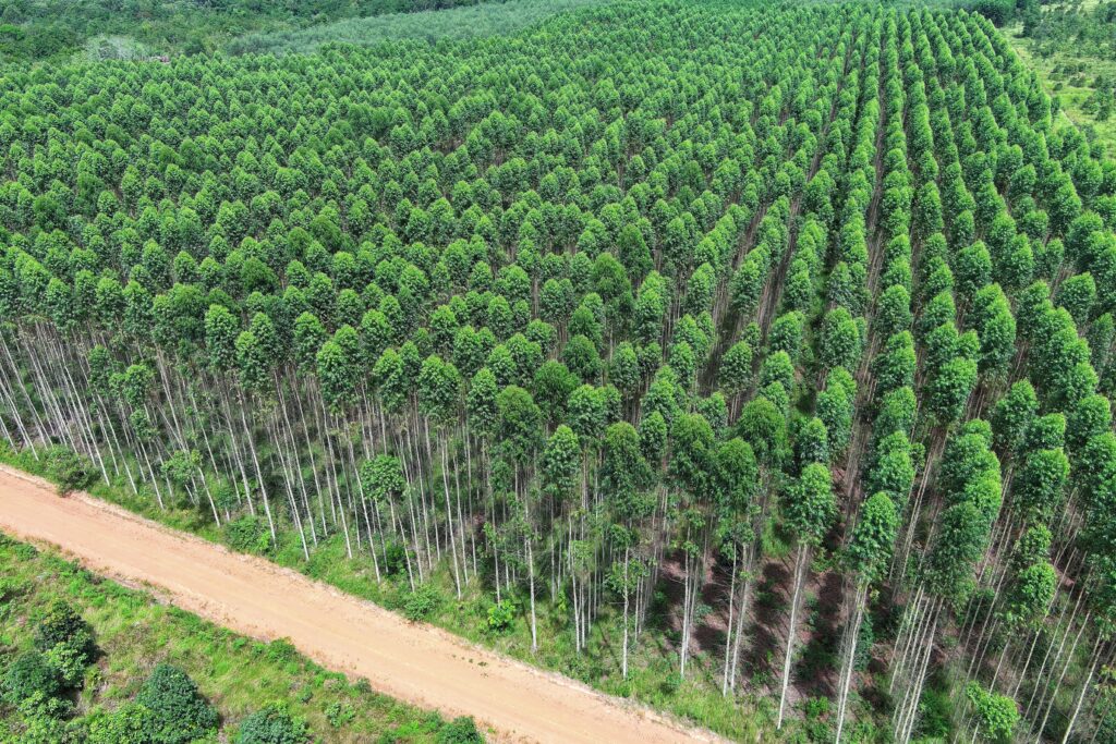
After harvesting, storm damage, fire, or disease, understanding what is actually happening on the ground is critical. Walking large tracts is slow, inconsistent, and often misses patterns that are only visible from above.
Drone-based replanting assessments allow operators to:
- Identify areas of successful regeneration versus poor survival
- Spot uneven spacing, gaps, or over-dense sections
- Detect competing vegetation that may suppress young trees
- Evaluate drainage issues impacting root establishment
- Document stand conditions for planning, reporting, or financing
Why aerial assessment matters:
Replanting decisions are most cost-effective when made early. Drones help determine whether a stand needs:
- Full replanting
- Partial infill planting
- Targeted vegetation management
- No intervention at all
This reduces wasted seedlings, unnecessary labor, and delayed growth cycles.
Access Road Planning
Smarter routes before equipment ever moves
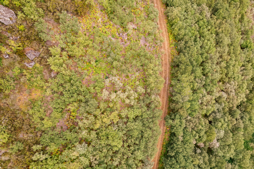
Access roads are essential—but poorly planned roads create erosion, drainage failures, safety risks, and long-term maintenance costs. Once cut, roads are expensive to correct.
Drones provide a bird’s-eye view that helps planners design efficient, low-impact access routes.
Drone-supported road planning helps with:
- Evaluating terrain slope and natural contours
- Identifying wet areas, seasonal drainage, and runoff paths
- Planning road placement to minimize soil disturbance
- Selecting optimal equipment access points
- Reducing unnecessary road length while improving reach
Operational benefits:
- Lower construction and maintenance costs
- Reduced erosion and environmental impact
- Safer movement of logging and support equipment
- Improved long-term usability of road networks
Why Drones Matter in Forestry Operations
Forestry decisions often involve large areas, limited access, and long timelines. Drones bridge the gap between ground reality and strategic planning.
They provide:
- Scale: See hundreds or thousands of acres quickly
- Consistency: Repeatable documentation over time
- Safety: Reduced need for personnel in difficult terrain
- Clarity: Visual data that supports confident decisions
Importantly, drone operations do not replace foresters or ground crews. They give those professionals better information before boots and machines hit the ground.
A Practical Planning Advantage
In forestry and timberland management, mistakes are expensive—and slow to correct. Drone-supported replanting assessment and access road planning help landowners and managers act with precision, reduce uncertainty, and protect long-term value.
Seeing the forest clearly—before making the next move—makes all the difference.