The best farmers Hugh MacDonald works with share a common trait: they pay attention to their soil before anything else. Every crop, every yield, every harvest starts with what’s happening beneath the surface. And increasingly, the smartest way to understand your soil is by looking at it from above.
Agricultural drones equipped with multispectral and thermal sensors are giving Florida farmers a powerful new lens on soil health — one that covers hundreds of acres in a single flight and reveals problems invisible from ground level.
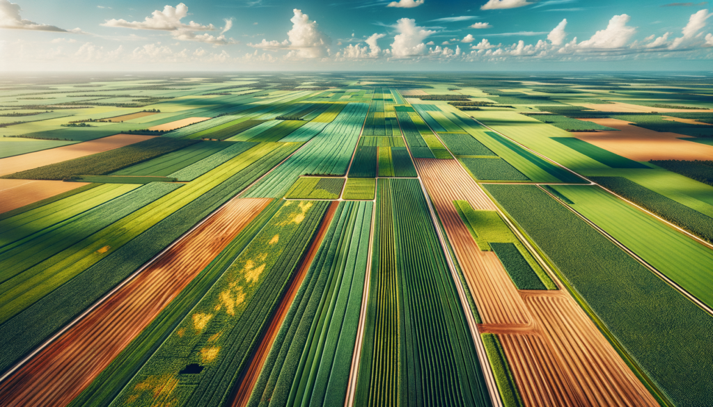
Why Soil Health Matters More Than Ever in Florida
Florida’s sandy soils present unique challenges. They drain fast, lose nutrients quickly, and compact unevenly depending on equipment traffic and irrigation patterns. Add in the state’s heavy rainfall events and subtropical heat, and soil conditions can shift dramatically from one part of a field to another.
Traditional soil sampling — walking a grid pattern and pulling cores — gives you point data. It tells you what’s happening in the exact spots you sampled. But it misses the variability between those points, and in Florida’s diverse soil types, that variability matters.
What Drones Actually See in Your Soil
Drone-mounted sensors don’t analyze soil chemistry directly. What they do is capture data that correlates strongly with soil conditions:
- Thermal imaging reveals moisture variation across a field. Wet areas show cooler, dry areas warmer. This pattern mapping helps identify drainage issues, compaction zones, and areas where irrigation isn’t reaching.
- Multispectral data shows how plants respond to soil conditions. Stressed vegetation in specific zones often points to nutrient deficiency, pH problems, or root-zone compaction underneath.
- Bare-soil imaging before planting captures organic matter variation, erosion patterns, and surface compaction — giving you a baseline before the crop even goes in.
Turning Aerial Data Into Ground-Level Decisions
The real value isn’t pretty maps — it’s targeted action. When a drone survey shows a thermal anomaly across the northwest corner of a field, that tells you exactly where to pull soil cores for lab analysis. Instead of sampling blindly across 200 acres, you’re sampling strategically based on what the data shows.
This approach saves money on lab costs, but more importantly, it catches problems that random sampling misses entirely. A compaction zone from last season’s harvest traffic. A low spot where nutrients are leaching. An area where cover crop residue didn’t break down properly.
Timing Matters: When to Fly for Soil Data
For Florida farmers, the best windows for soil-focused drone flights are:
- Pre-plant (bare soil): Right after field preparation, before planting. This gives you the clearest read on soil surface conditions without crop interference.
- Early season: Two to three weeks after emergence, when young plants are responding directly to soil conditions rather than canopy-level factors.
- Post-harvest: After crop removal, to assess what the season did to your soil and plan amendments for the next rotation.
Part 137 Certification: Why It Matters for Agricultural Drone Work
Soil assessment flights over active farmland require a Part 137 agricultural aircraft operator certificate from the FAA. This isn’t optional — it’s federal law for any drone operation tied to agricultural production. Precision Aerial Services holds this certification, which means every flight meets the safety and operational standards that protect both the farmer and the operation.
Some operators try to work around this requirement. Don’t let them. If something goes wrong on your property with an uncertified operator, the liability falls in uncomfortable places.
Building Better Ground, One Flight at a Time
Soil health isn’t a one-time fix. It’s a season-over-season commitment — building organic matter, managing compaction, adjusting inputs based on what the ground actually needs rather than what a generic recommendation says.
Drone surveys fit naturally into that long-term approach. Fly before you plant. Fly early season. Fly after harvest. Over time, you build a dataset that shows exactly how your soil is responding to your management decisions.
As Hugh often says, good stewardship of the land starts with understanding what the land is telling you. Sometimes the clearest message comes from 200 feet up.
If you’re farming in Central Florida and want to see what drone-based soil assessment could reveal about your fields, reach out to Precision Aerial Services. We’ll help you see your ground in a whole new way.