Water is the lifeblood of every farm. But for Florida growers dealing with sandy soils, unpredictable rain patterns, and rising water costs, knowing exactly where your water is going—and where it’s being wasted—can mean the difference between a profitable season and a frustrating one.
That’s where drone-based irrigation monitoring comes in. At Precision Aerial Services, we use advanced aerial imaging to give farmers a clear picture of how water moves across their fields, so they can make smarter decisions without guessing.
The Problem With Traditional Irrigation Checks
Most farmers know their fields have dry spots and wet spots. Walking rows or checking a handful of soil probes gives you a snapshot, but it doesn’t tell the whole story. You might catch a broken emitter on one end of the field while missing waterlogged soil on the other.
Traditional methods are time-consuming, physically demanding, and limited in scope. By the time you spot a problem on foot, the damage is often already done—stressed plants, wasted water, and money down the drain.
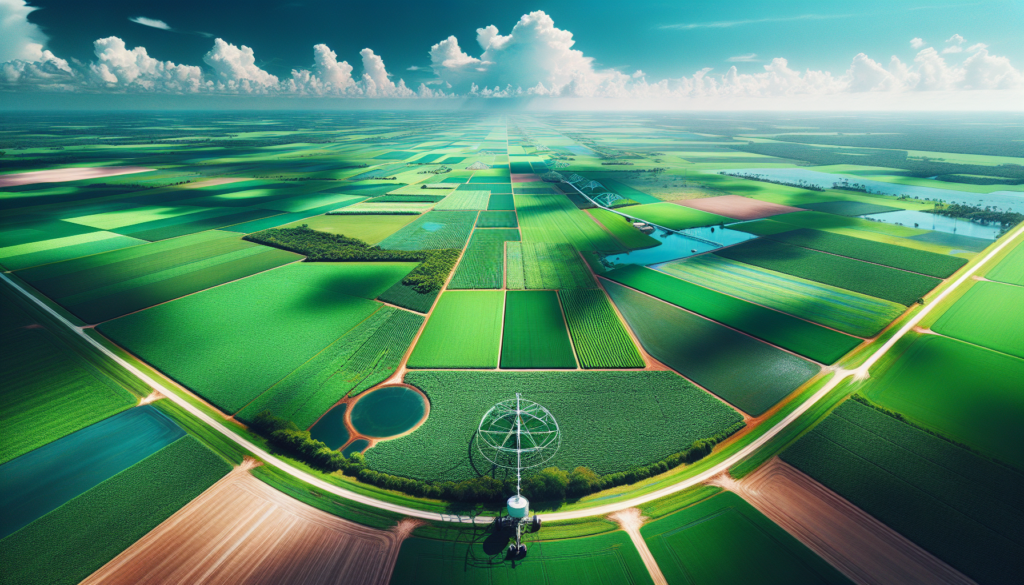
What Drones Can See That You Can’t
Agricultural drones equipped with multispectral and thermal sensors capture data across your entire field in a single flight. Here’s what that means in practical terms:
- Thermal imaging identifies cool, well-watered zones versus hot, stressed areas—often before visible wilting occurs
- NDVI mapping shows plant health patterns that correlate directly with irrigation coverage
- Elevation models reveal low spots where water pools and high spots that dry out fast
- Time-series comparisons track how your irrigation system performs over weeks and months
Instead of checking a few spots and hoping for the best, you get a complete, data-driven view of every acre.
Real Savings for Florida Operations
Florida’s water management districts are increasingly focused on agricultural water use. Farmers who can demonstrate efficient irrigation practices are better positioned for permitting and compliance. But beyond regulatory concerns, the economics are straightforward.
Farmers using drone-based irrigation monitoring typically find that 15-25% of their field receives too much or too little water. Correcting those imbalances can save thousands of gallons per season while improving crop uniformity and yield.
For operations running center pivots, drip systems, or flood irrigation, the data helps you adjust nozzle spacing, run times, and pressure settings based on what your field actually needs—not what you assume it needs.
How the Process Works
Working with Precision Aerial Services is straightforward:
- Pre-flight consultation — We discuss your irrigation setup, crop type, and specific concerns
- Aerial survey — Our Part 137 licensed pilots fly your fields with calibrated sensors
- Data processing — We generate thermal maps, NDVI layers, and actionable reports
- Review and recommendations — We walk through the findings and help you prioritize fixes
Most farms can be surveyed in a single morning. You’ll have usable data within 48 hours.
Timing Matters
Late winter and early spring—right now—is the ideal time for a baseline irrigation assessment. Before your main crop goes in, you can identify system issues, adjust your layout, and start the season with confidence that every drop of water is going where it should.
Mid-season flights are valuable too, especially during Florida’s dry stretches when irrigation efficiency becomes critical. Regular monitoring lets you catch problems early instead of discovering them at harvest.
Good Stewardship, Better Farming
We believe God gave us these fields to tend well. That means being smart with the resources we’re given—including water. Drone technology isn’t about replacing a farmer’s instincts. It’s about giving you better information so those instincts can do their best work.
If you’re farming in Central Florida and want to see what your irrigation system is really doing, give us a call. Hugh MacDonald and the Precision Aerial Services team are ready to help you grow smarter this season.
Precision Aerial Services — Dover, Florida
Part 137 Licensed | Serving Florida’s Agricultural Community
📞 Contact us to schedule your irrigation assessment